 New visualization released yesterday.
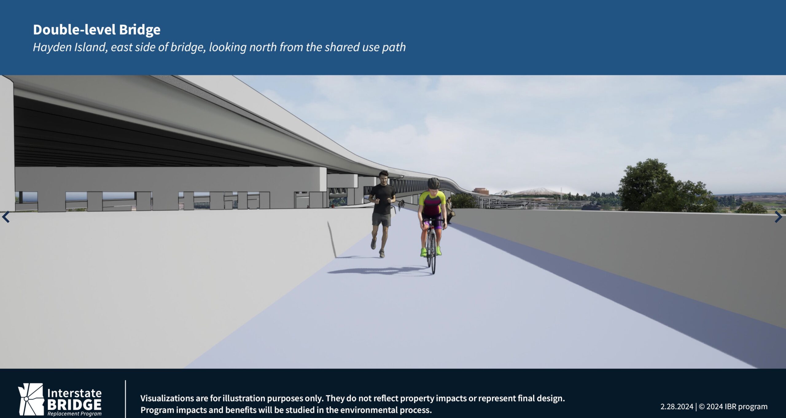
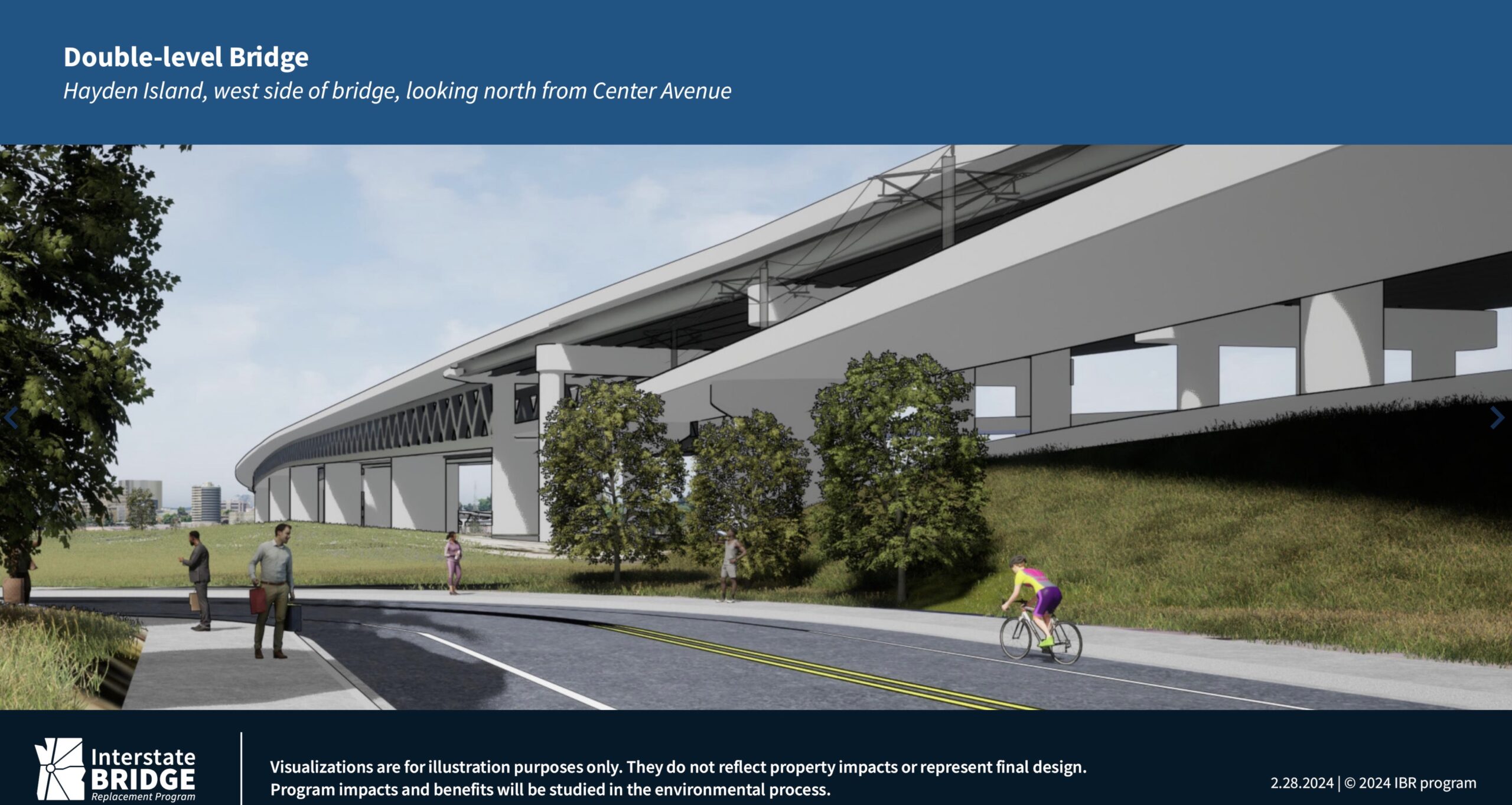
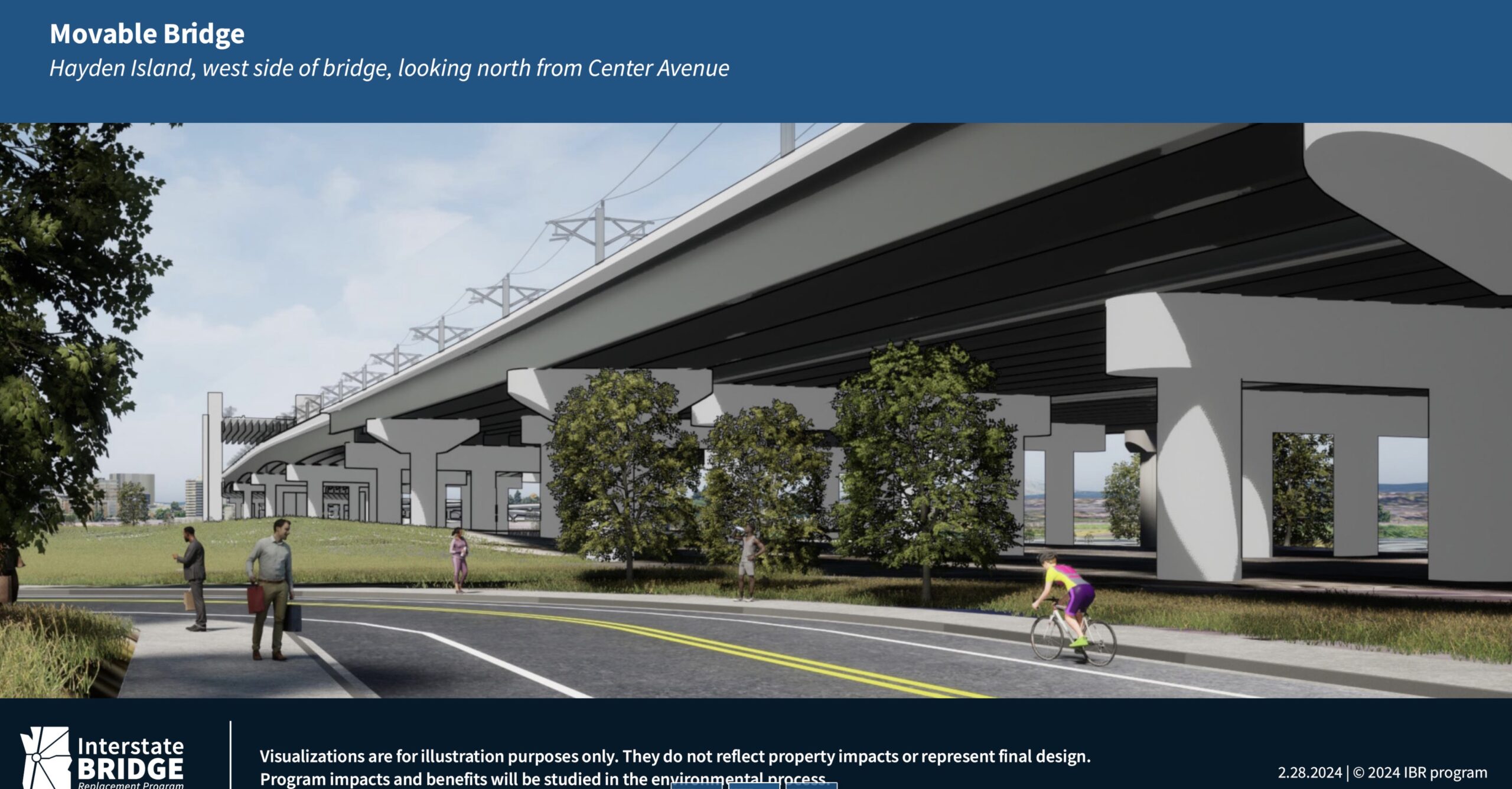
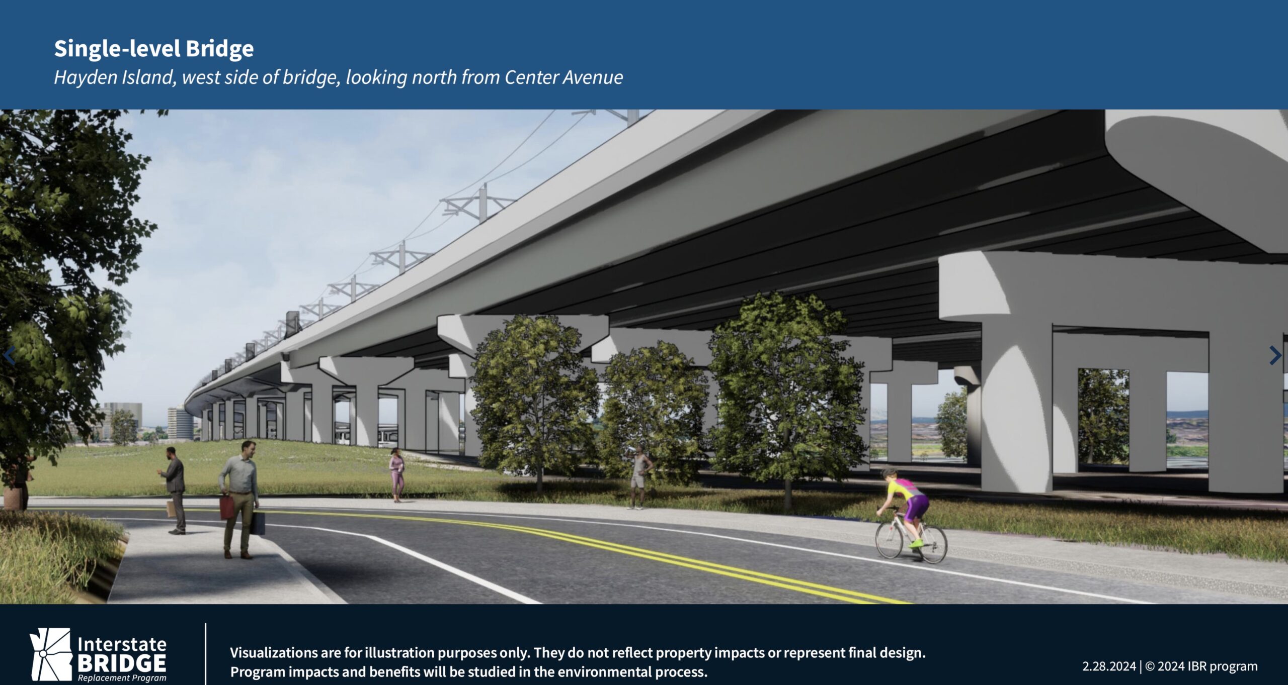
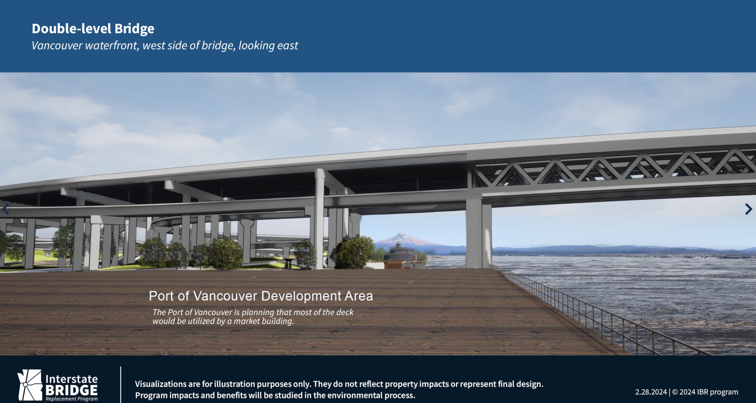
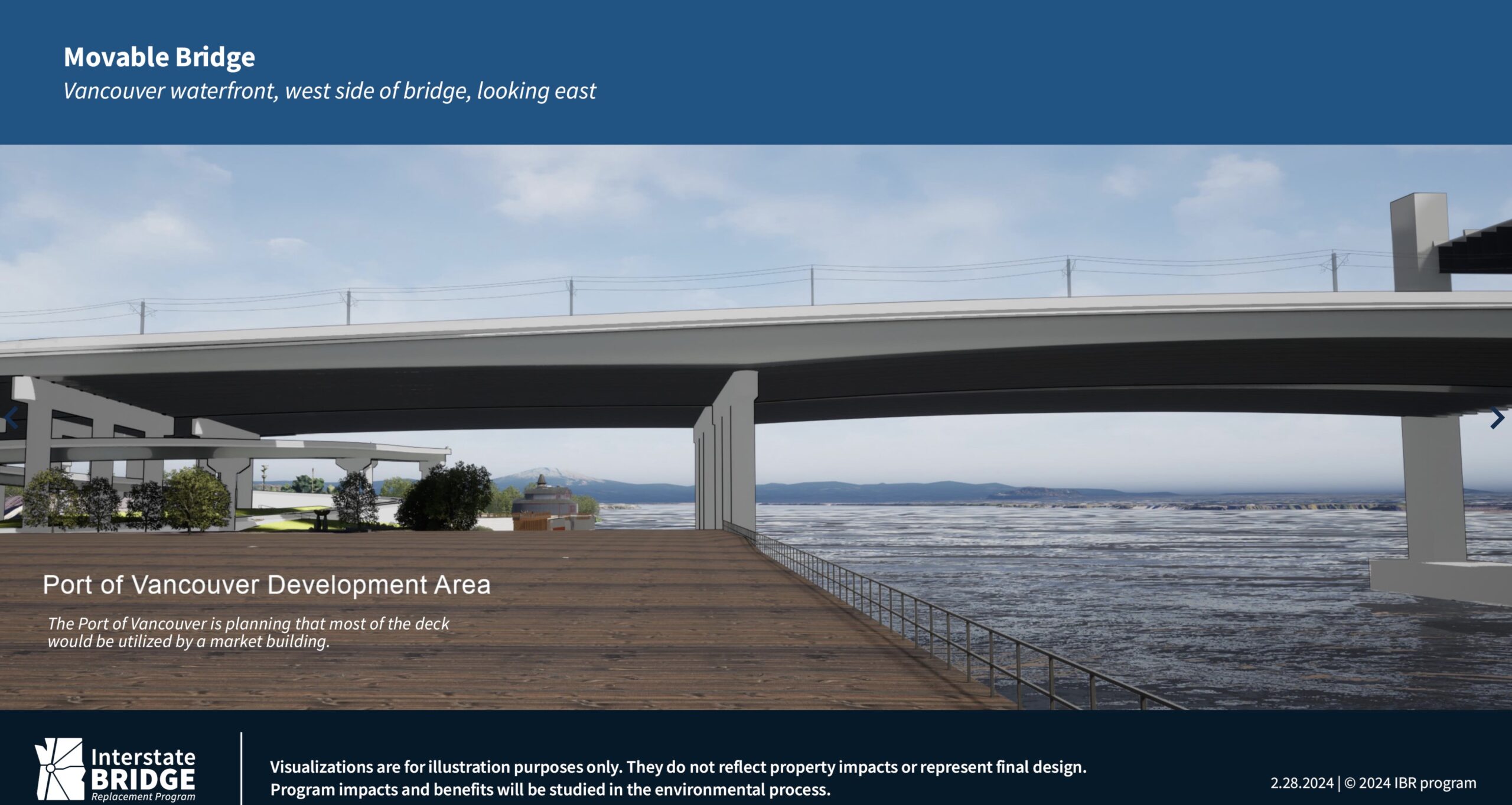
The folks working on a new Interstate Bridge and expansion of I-5 between Portland and Vancouver released new visualizations yesterday, including our best view yet of the potential new bike path.
The new drawings were released at a meeting of the Executive Steering Group, one of several committees formed to garner feedback on the (estimated) $6-7.5 billion Interstate Bridge Replacement Program. The ESG is made up of agency leaders and elected officials from Portland and southwest Washington. ESG members have already adopted a set of desired outcomes for the future bicycle and pedestrian facilities. Among them are that the new bikeway must “feel safe” and be “separated from moving vehicles” and that the path environment is “visible and connected.” They’ve also expressed a desire for bikeways to be “high quality,” “convenient,” and to “connect to important destinations.”
The ESG and IBRP team are currently finalizing their Draft Supplemental Environmental Impact Statement (Draft SEIS), which is due out later this spring.
IBRP Administrator Greg Johnson presented the visualizations at the meeting (where he also said they’re working on new videos that will explain how bicycle riders and walkers will make their way through the corridor). Johnson stressed that the drawings shown yesterday are not final and are, “Not for decision-making or narrowing options.” “These are just to give perspective on the size of the bridge as related to, if you’re standing on the ground on Hayden Island or on the Vancouver Waterfront.”
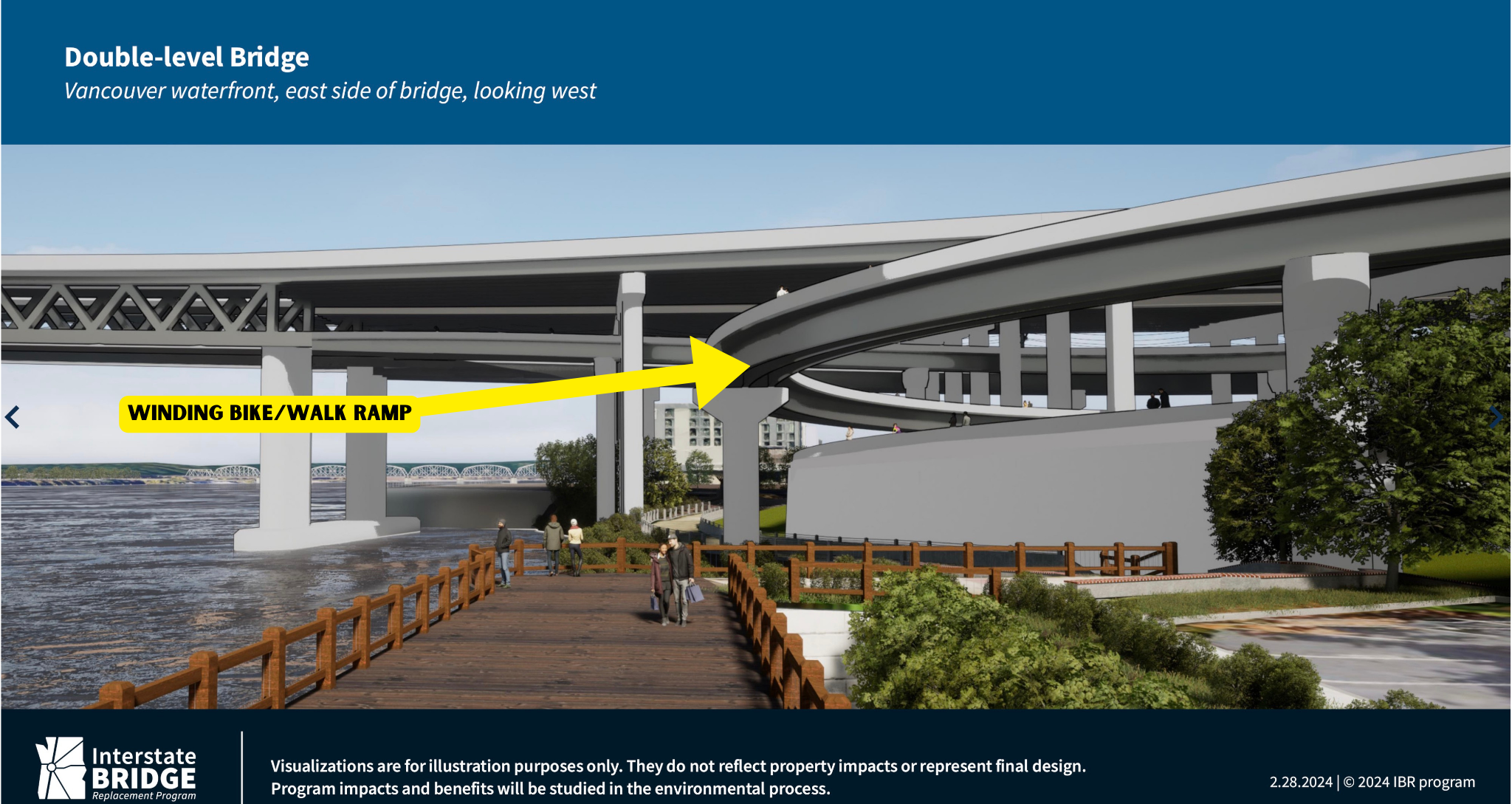
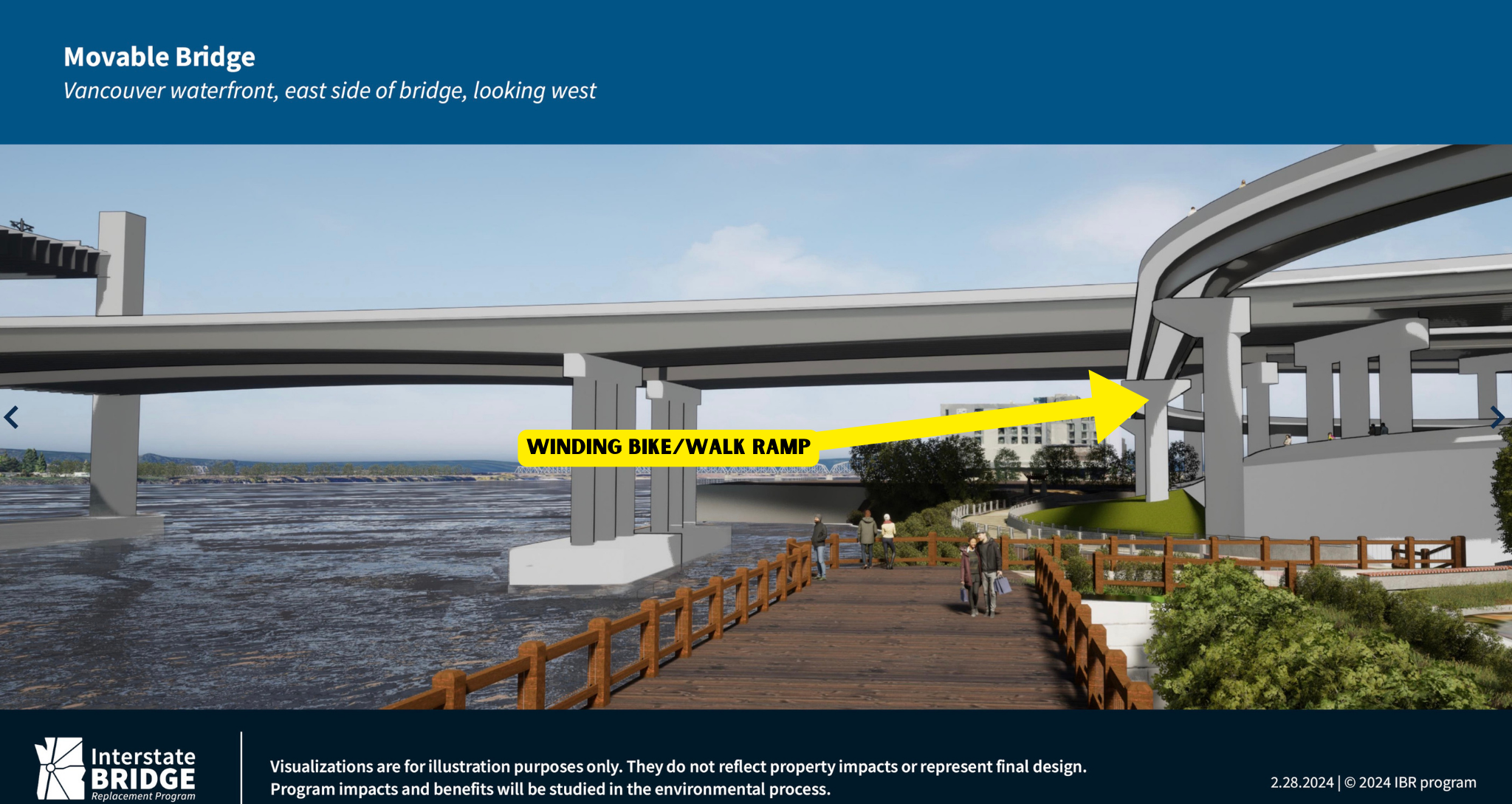
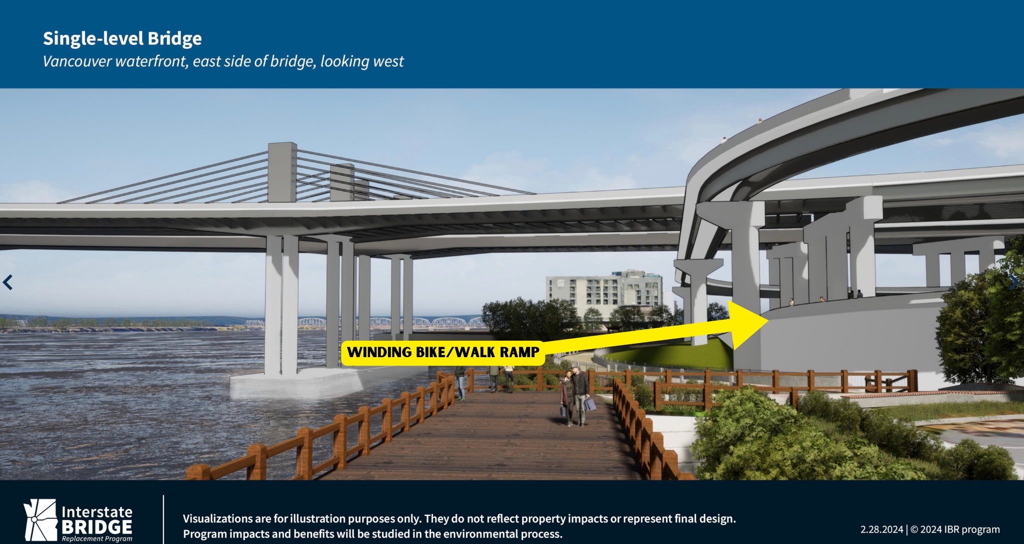
The IBRP released 12 visuals in total — three for each possible bridge option currently being analyzed in the Draft SEIS: single level, movable span, and double-level.
As he shared the slides, Johnson acknowledged, “This [bridge] is going to be a bigger bridge than currently exists.” “And this will have impacts on Hayden Island, but we think there will also be very positive impacts by reconnecting the island and providing access from Tomahawk Drive from east to west and by making a walkable community on Hayden Island.”
For the visual of the bike path specifically, Johnson said, “We haven’t determined the full width of what what this active transportation pathway would look like.”
See all the drawings below:
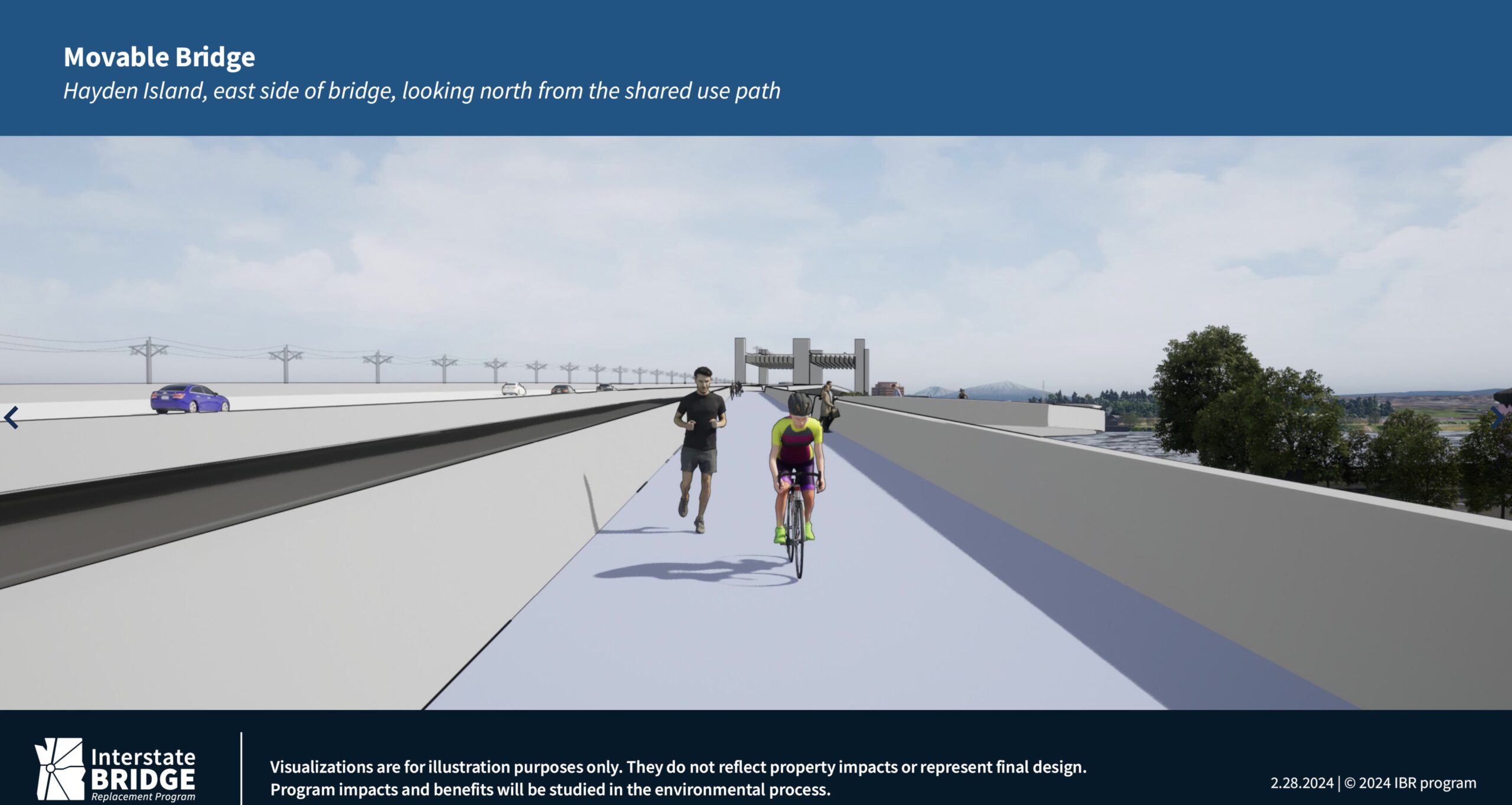
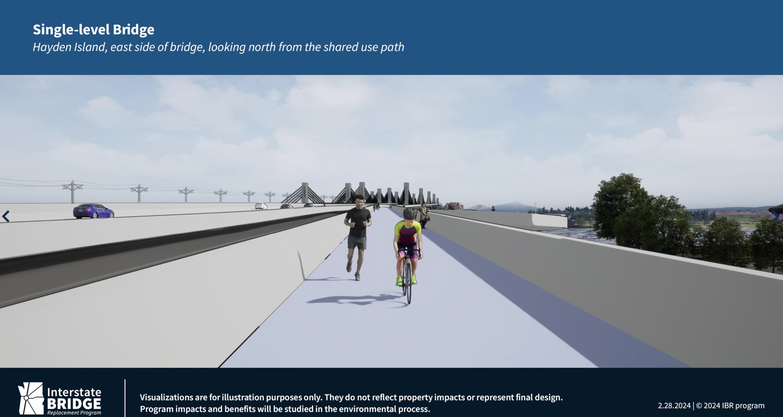
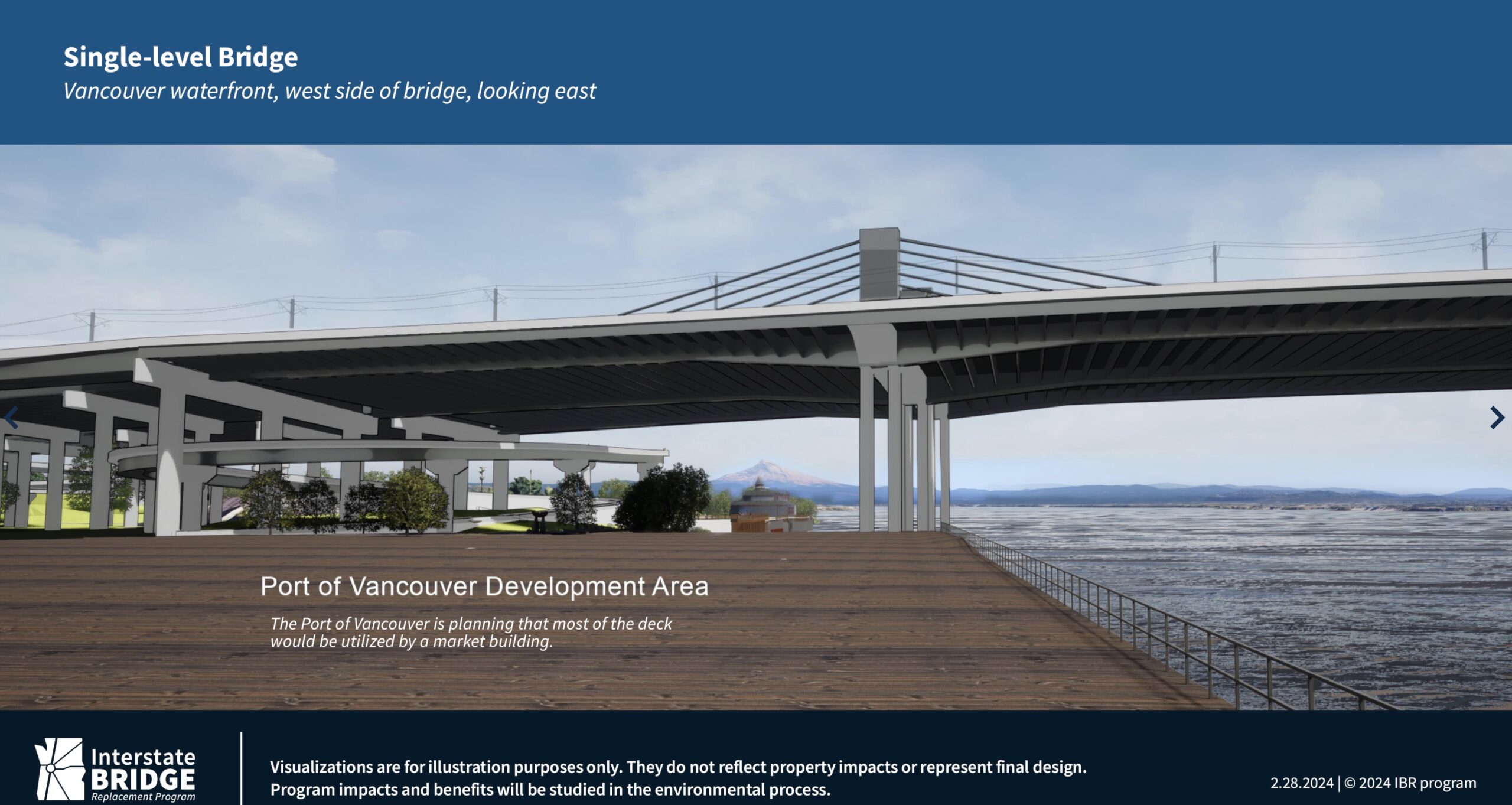
Note the spiral bike path in these drawings. The ramp to connect to the bridge for non-drivers will be very long and circuitous because it must reach a height of 116-feet and have a maximum slope of 4.5%.
While it’s interesting to see more details about what the future bridge might look like, I can’t help but wonder why none of the new visualizations offer us a look at any of the seven new interchanges or new frontage roads, or a detailed view of what it will look like to drive on the five miles of wider freeways. The team of PR consultants and agency leaders behind this megaproject, which has $1 billion commitments from Oregon and Washington and recently won a $600 million grant from the US Department of Transportation, have a long record of hiding the true nature and scope of this project. Almost all the IBRP public communications focus on “bridge replacement” when the fact is only about $500 million of the project’s $6 to $7.5 billion estimated cost will be for the bridge.
The less popular and more controversial aspects of this project like the additional freeway lanes and interchange ramps that will incentivize single-occupancy car use, lower the quality-of-life for everyone in the region, and were recently called out as being indicative of a “climate time bomb” by advocacy group Transportation For America, are rarely shown.
In a public comment period at the end of the meeting, persistent IBRP critic and retired infrastructure expert Bob Ortblad had a warning for ESG members. “This group should remember the history of the Embarcadero Freeway and the Alaskan Way Viaduct and how they despoiled their waterfront. Imagine if both of those were build side-by-side, they would equal the width of each of the two IBR bridge approaches on Vancouver and Hayden Island.
If these approaches are built, our children will tear them down.”