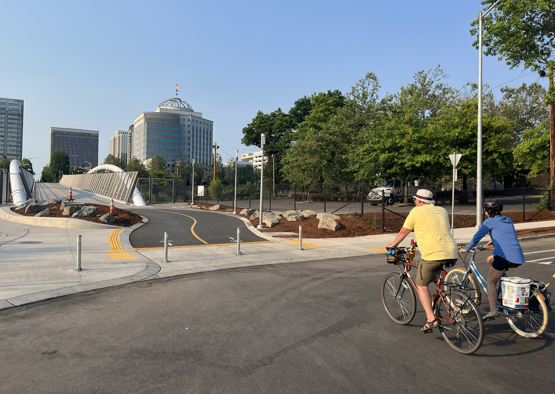
 Friends of the Green Loop Executive Director Keith Jones (in yellow) used the Blumenauer Bridge as a launching point for a Green Loop route tour on Sunday. (Photos: Taylor Griggs/BikePortland)
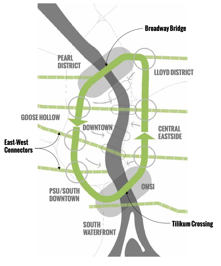 The Green Loop mapped. (Source: City of Portland)
Last weekend, one of Portland’s most ambitious planning projects got a big boost. With the Earl Blumenauer Bridge now open as a new carfree path across I-84, the Green Loop plan to connect a six-mile linear pathway through all four quadrants in Portland’s central city has closed a critical gap and the vision is more cohesive than ever.
With the opening of the new bridge, it’s finally possible to travel around the entire Green Loop path without stepping out of its central city boundaries. After the dedication ceremonies for the bridge on Sunday afternoon, I accompanied Keith Jones, executive director of Friends of the Green Loop, on a six-mile ride on streets, paths and bridges that he and other loop boosters say will form the backbone of the route.
The Green Loop project is a conceptual idea for a ring around Portland’s city center described in the Portland Bureau of Transportation’s Central City 2035 plan. Its implementation plan describes the loop as a “destination or activity in and of itself” with a “unique combination of leafy green canopy, urban pedestrian plazas, comfortable mobility zones and engaged adjacent development.” It’s one part active transportation path, one part relaxed hangout space, one part opportunity for central city businesses.
“I can see how the Green Loop will connect the dots between active pedestrian traffic and Portland’s small businesses.”
“It will be our ‘Urban Promenade,’ promoting walking, jogging, biking and connecting people to light rail and streetcar as ways to get to hard-to-reach places. It will be an amenity that draws people from around the region to a different kind of recreational destination, an urban trek through the city — safe, green, active, vibrant and fun for all ages and abilities,” the plan reads.
This plan has been in the works for some time, but projects of this magnitude can’t all come together at once. However, the puzzle pieces that will make up the Green Loop have been connecting throughout the last several years: the carfree Tilikum Crossing is already in place as the loop’s southern connector across the Willamette River, and the route can utilize existing bike paths in South Waterfront, which may serve as the template for paths throughout the rest of the loop.
The Cart Blocks plaza opened on the Green Loop route along the North Park Blocks downtown last year as the first step in the planned downtown “culinary corridor” of food carts and farmers markets. Green Loop boosters think this foodie row can one day be as successful as the beloved Alder Street Food Cart Pod displaced by Ritz-Carlton construction in 2019.
On Sunday, Jones described the Green Loop to me as a “connected path of community spaces that goes around the city,” but also pointed out that these community spaces need support in the form of physical infrastructure in order for the project to come to life. The streets that make up the route will need a major renovation so people walking, biking and rolling can be prioritized over people driving cars.
 Jones at the Cart Blocks.
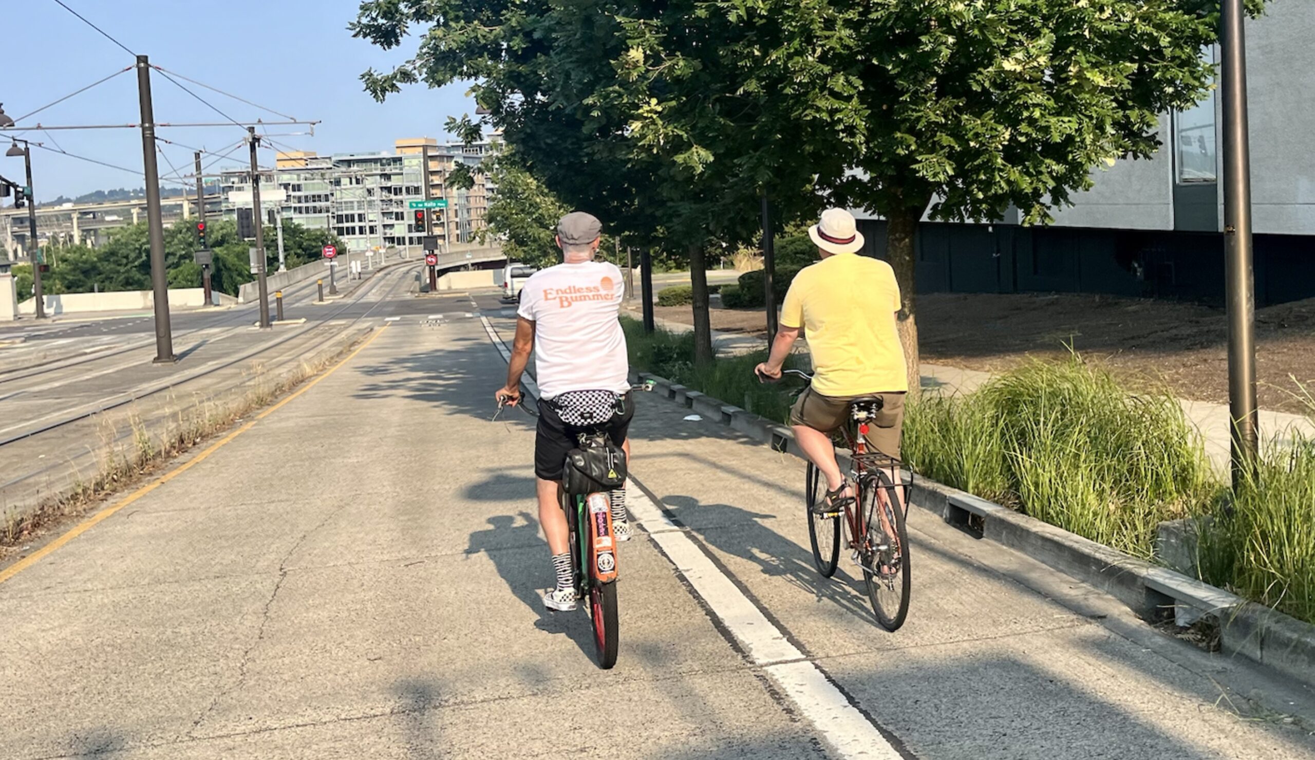 Riding east toward Naito Pkwy on SW Lincoln.
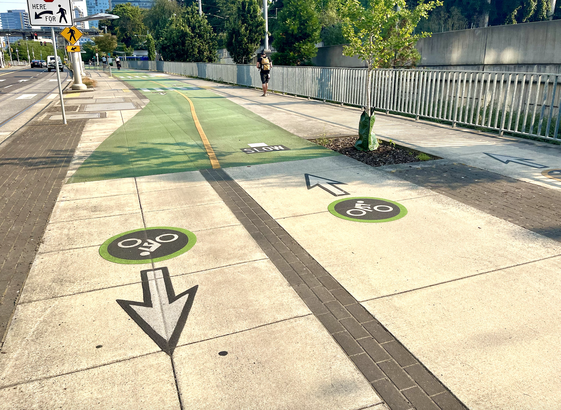 This two-way bike lane in South Waterfront could be the template for bike infrastructure on the Green Loop.
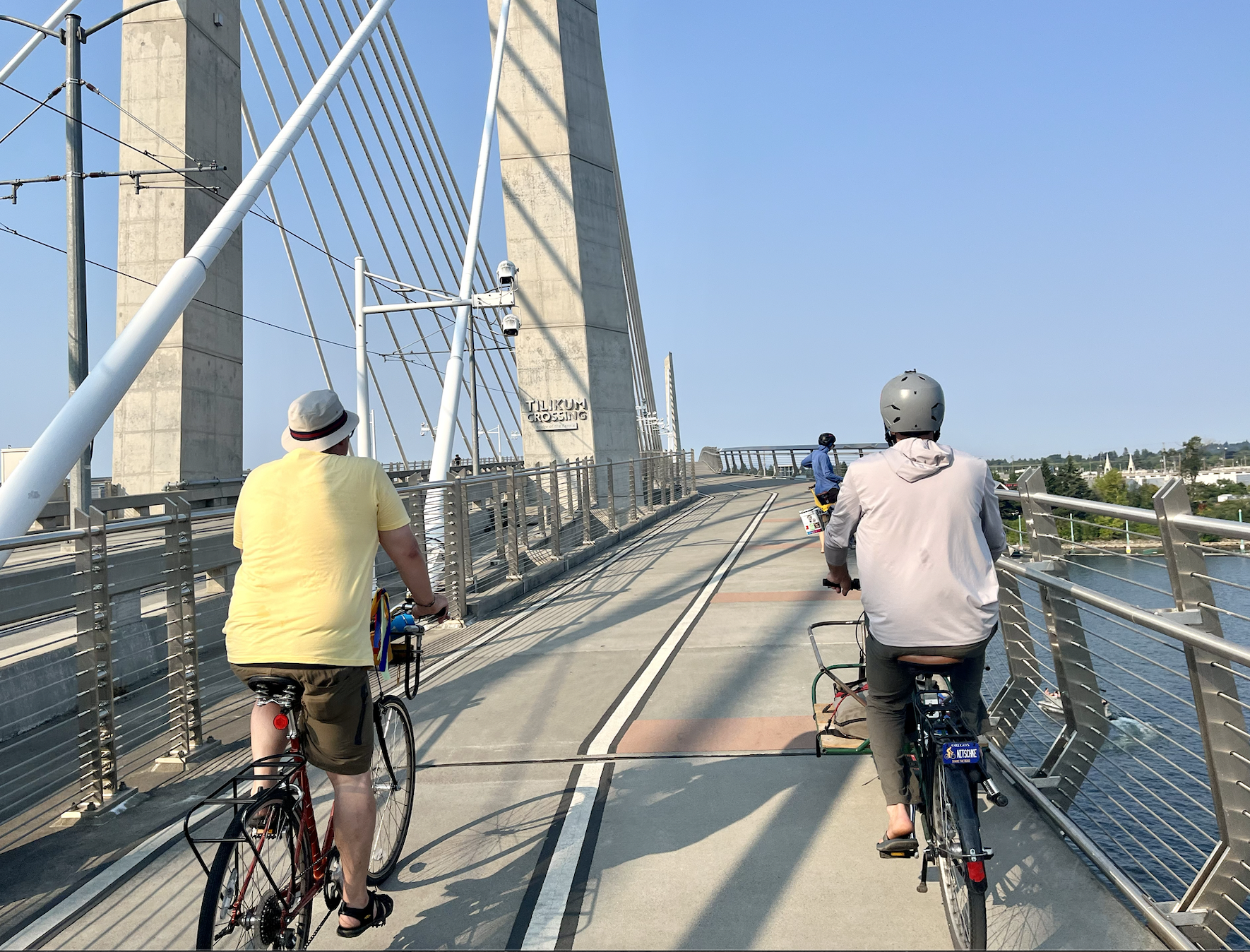 The Tilikum Crossing is the Green Loop’s marquee southern connection.
Jones led a small group of riders who were up for braving Sunday’s sweltering heat to check out the bones of the loop. We started north of the new Blumenauer Bridge, heading west on NE Broadway to cross the Broadway Bridge, which forms the north tip of the loop across the Willamette. Jones doesn’t want the Green Loop to utilize the Broadway/Weidler couplet, which has only thin, unprotected bike lanes, to get from the Lloyd District to the Rose Quarter. Instead, he’d prefer it utilizes NE Holladay. But the details of this segment aren’t entirely clear, complicated by the proposed I-5 expansion project at the Rose Quarter nearby.
Once we crossed the Broadway Bridge, Jones pointed out the former U.S. Post Office site, which the city has big plans for. Dubbed the Broadway Corridor, this area is set for development over the next two decades, and it will eventually be a key part of the Green Loop. Right now, however, it’s mostly a barren mass of concrete.
After a quick stop at the Cart Blocks which are located south of W Burnside St between Park and 8th Avenues, we rode south down SW 9th/Park Ave through downtown and the South Park Blocks, making our way toward the Tilikum Crossing to head into the central eastside.
In contrast to the leafy canopy along the Park Blocks downtown, the central eastside has very few carfree plazas or green spaces whatsoever. The Green Loop will utilize 6th Ave as its main corridor on the east side, and there’s a lot that needs to be done there to make it a nice space. Where some might see industrial desolation, however, Jones and the Green Loop advocates see potential.
Kate Merrill, who’s on the Friends of the Green Loop Board of Advisors, pointed out the value of adding green space to the pavement-heavy central eastside, which the Green Loop would help accomplish.
“It’s more important than ever to add green to many areas in the urban core that are currently heat islands, including many routes through the central eastside, as climate change becomes more severe,” Merrill said.
Jones says the central eastside is where business owners are most enthusiastic about the Green Loop, which would go hand-in-hand with development plans for the Oregon Museum of Science and Industry property to transform the neighborhood.
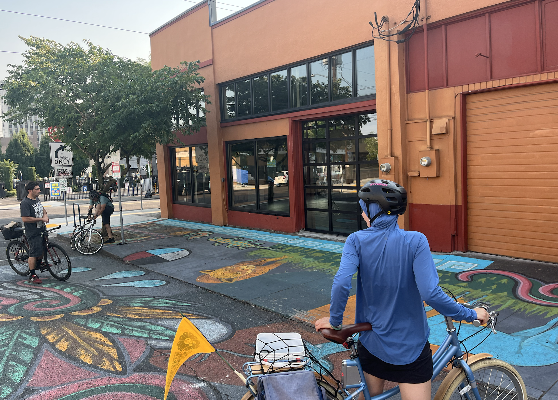 The street mural outside Milagro, a Latino arts and culture center on SE 6th Ave, demonstrates what some parts of the Green Loop could look like.
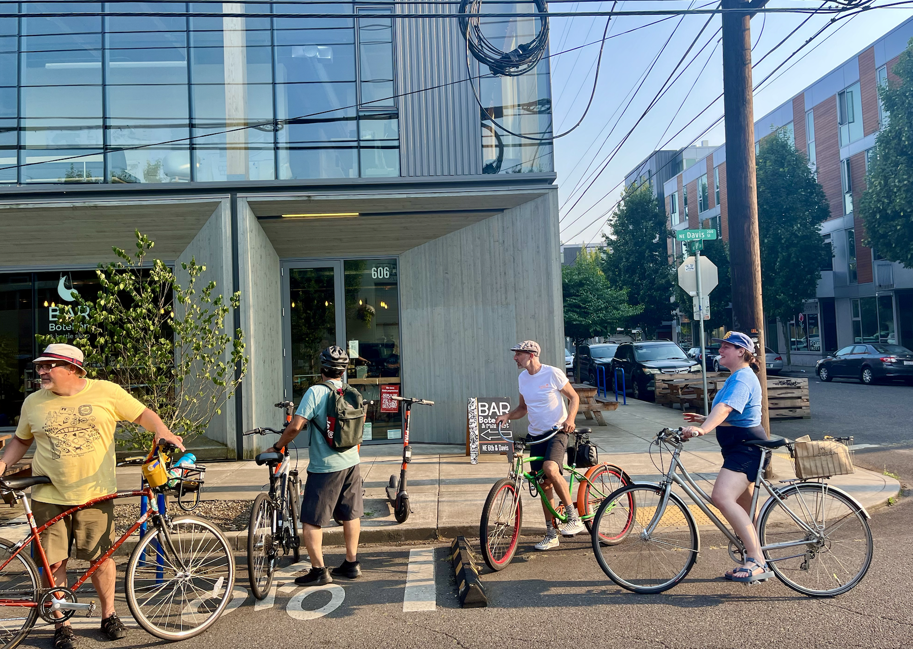 Bar Bottelón on SE Davis and 6th Ave is one of the businesses most supportive of the Green Loop.
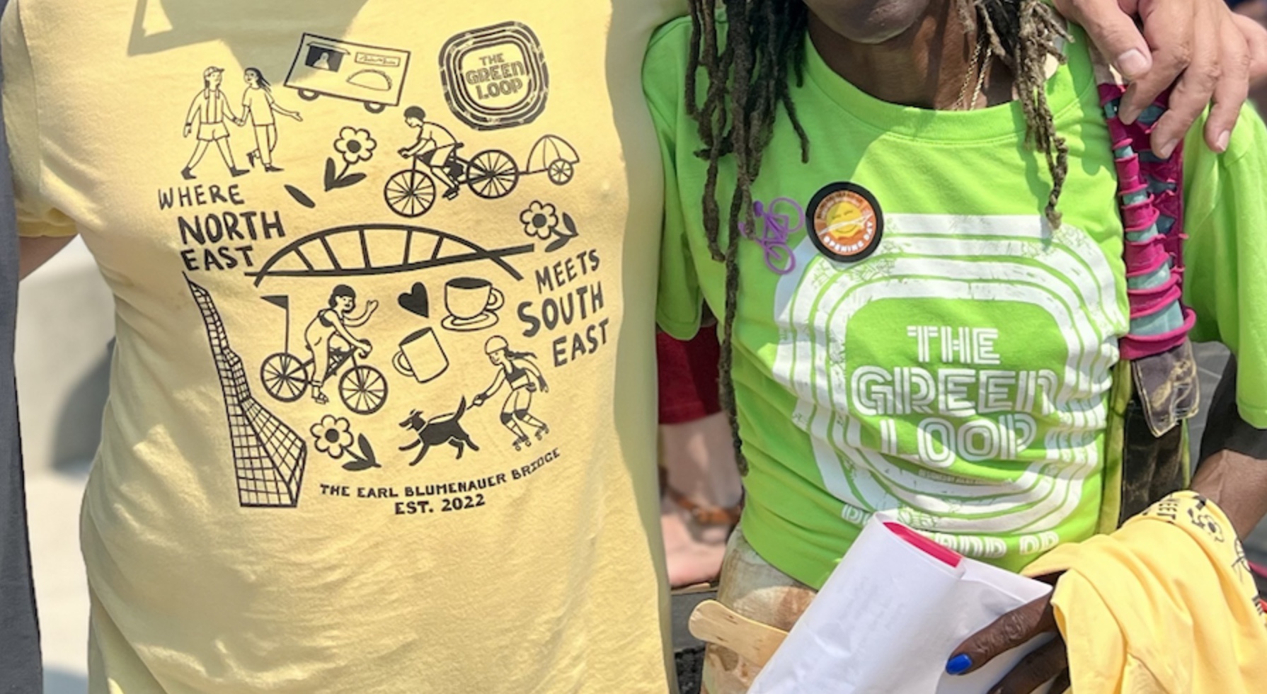
Jones initially worried that the Green Loop wouldn’t get the attention it deserves at the Blumenauer Bridge celebration. But he was pleasantly surprised at the exposure it received: Commissioner Jo Ann Hardesty was wearing a Green Loop t-shirt during her speech and Congressman Earl Blumenauer gave it a shout out as well. Jones also led Portland City commissioners Mingus Mapps and Dan Ryan (and staff from Carmen Rubio’s office) on a tour of the Green Loop in the central eastside, where they spoke with business owners who are excited about the the project. Jones said he wanted to demonstrate to city staff the “people aspect” of the loop. And he seems to have earned another important fan.
“I can see how the Green Loop will connect the dots between active pedestrian traffic and Portland’s small businesses,” Commissioner Ryan commented on Facebook after the ride.
For those who are now Green Loop curious, you won’t have to wait too long for more updates. Jones says a “Green Loop Landing” plaza will debut at the south end of the Blumenauer Bridge this month – more details on that to come. And urban re-greening group Depave is tackling a project to reinvigorate a stretch of pavement on SE 7th Ave between Stark St and Sandy Blvd, which would also be in the Green Loop’s line of sight.
For now, it was impactful to imagine what such a project could do for Portland. It’s clear there are whet appetites for bold plans here. Why not think big?
Taylor has been BikePortland’s staff writer since November 2021. She has also written for Street Roots and Eugene Weekly. Contact her at This email address is being protected from spambots. You need JavaScript enabled to view it.