(Jonathan Maus – BikePortland)
*This post is from Erin Bailie. She writes our New to Portland column. Find previous installments here.
Last week, I went to my first Blazers game. I asked a few folks at Bike Happy Hour for advice on riding to the game and where to lock a bike at Moda Center. Several folks immediately pulled out their phones to show me their favorite routes and parking spots, and I quickly realized that everyone seemed to open a different app to show bicycle navigation around the city.
There’s not just one way to find your way around Portland, as exemplified in the variety of apps folks referenced at Bike Happy Hour. In today’s post, I’ll share a few tools I’ve found helpful.
A few notes on my approach:
For each tool, I mapped the same route (from Bike Happy Hour in Kerns to Moda Center in Rose Quarter) so I could have a steady comparison.
Some of these services offer additional features for a monthly subscription fee, but everything you see here is based off of free versions.
I’ve got a generous data plan on my phone, but I’ve tried to account for how each app works with no data connection.
This blog has heavy overlap with my day job (usability research). I wish I could say ‘I’m sorry if this gets too nerdy’… but I’m not sorry. I love this stuff.
OK. Here we go…
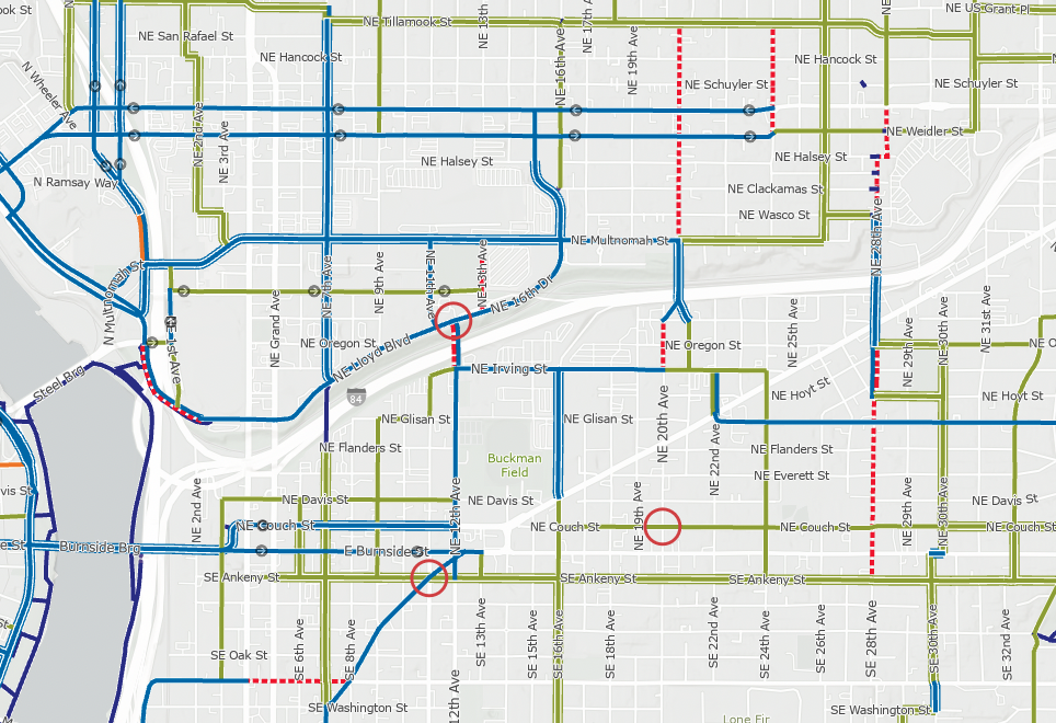 Detail of City of Portland bike map
Find it at:
Portland.gov/transportation
Cost: free
Format: paper and digital (desktop and mobile)
How it works: The Portland Bike Map is a detailed map of bike infrastructure across the city. The map encompasses the entire city, including detailed sections for downtown. It uses color-coded lines to note 10 distinct types of bike infrastructure – from shared roadways to multi-use paths (paved and unpaved!). It even notes “difficult connections” and one-way sections.
Low-data friendly?: Yes, via a physical paper map or by downloading a 3.38MB PDF while connected to Wifi.
Ideal for: Planning your route before you head out the door. The map offers a bird’s eye view of infrastructure options in an area. I like to use the map to plan a leisurely ride and know what alternatives exist for getting to my destination. In fact, I used this map to plan my trip to Powell Butte a few weeks ago.
Not ideal for: On-the-go route-finding. It’s just a map, there are no point-to-point directions. I also find it hard to use on a mobile screen, because I usually need to zoom way out to see my whole route.
 (Erin Bailie – BikePortland)
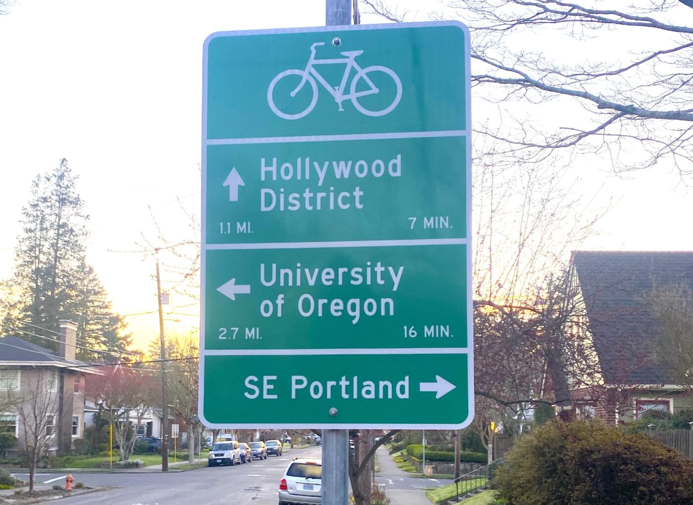
Cost: free
Format: street signs and on-pavement markings
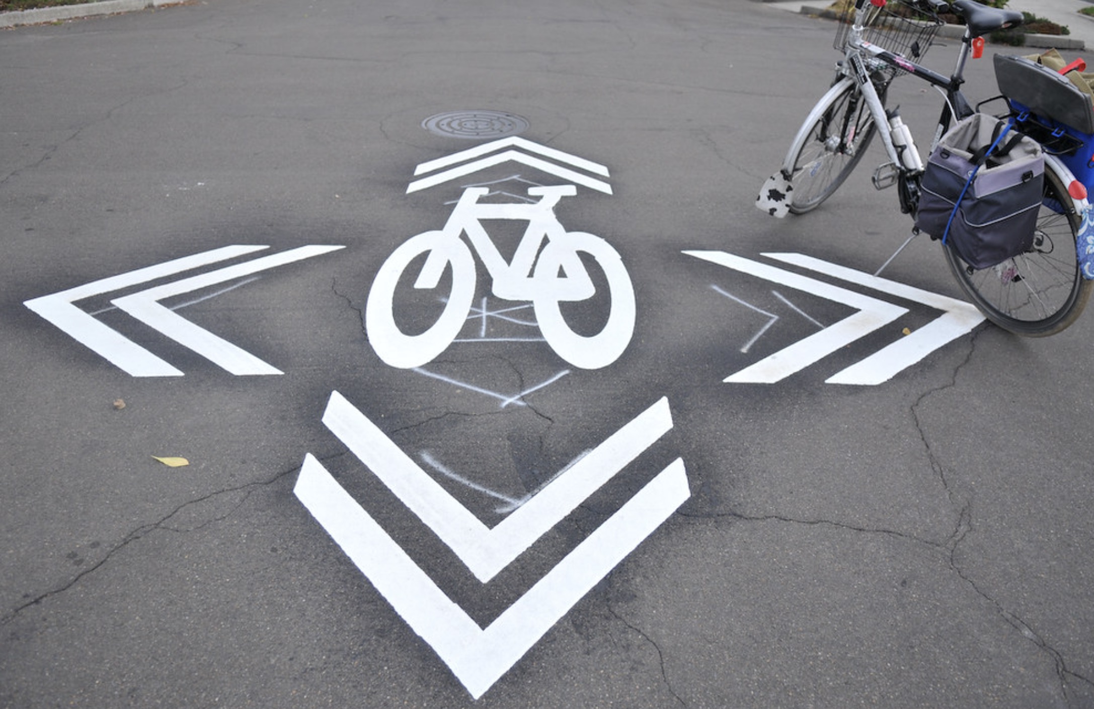
How it works: Neighborhood Greenways are a network of shared roadways on low-speed, low-traffic streets. Greenways often have protected crossings for major intersections and diverters to stave off vehicle traffic. You’ll know you’re on a Neighborhood Greenway by the orange bicycle fixture on the street sign and the on-street painted sharrow markings. Green signage at intersections with other Greenways helps you navigate to your desired destination.
Low-data friendly?: Yes! No data needed.
Ideal for: Just about everything! I’ve only found one downside, which I’ve mentioned below
Not ideal for: The signs show the next-closest neighborhood. This means that if you’re traveling several miles, you’ll need to know the names of the neighborhoods along the way so you can pick the right direction to go. It’s similar to choosing a direction on the interstate – the sign will say the next-closest destination in any direction. If your destination is farther than that, you’ll have to know which direction to choose. [Or, if you’re looking for a sneaky upside, it’s this: using Neighborhood Greenways exposes you to all the areas in between point A and point B.]
 Pointz screenshot
Find it at:
BikePointz.com
Cost: free
Format: a mobile app
How it works: Pointz is a bicycle mobility app which offers point-to-point routing.
Low-data friendly?: No. Cellular connection needed for routing.
Ideal for: On-the-go navigation, with on-screen or audio turn-by-turn directions. You can toggle your preferences for street safety, avoiding hills, taking shortcuts, etc. to develop the right route for you. I use Pointz when I don’t want to think very much about which way is best to go.
Not ideal for: Folks without a mobile data plan. Pointz does rely on mobile data to compute routing.
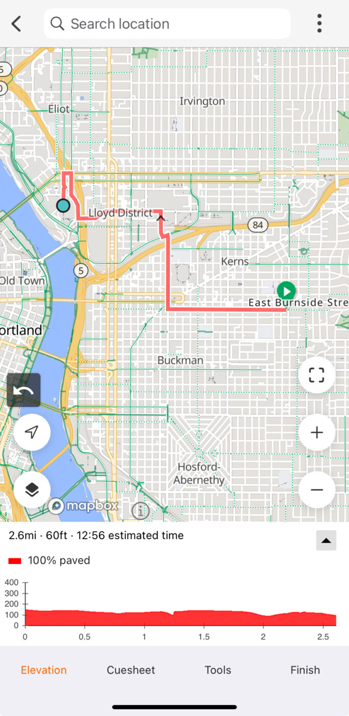 Ride With GPS screenshot
Find it at:
RideWithGPS.com
Cost: free, with premium licenses available
Format: mobile app and website
How it works: RideWithGPS is a powerful route planner, and it creates GPS files that you can upload to a bicycle computer (like a Garmin or a Wahoo).
Low-data friendly?: If the route is saved while connected to Wifi, yes.
Ideal for: Planning, drawing, and sharing routes – and discovering routes published by others – to be run on a GPS computer. RideWithGPS has a powerful route planning tool which selects the best route between two selected points. Premium tiers offer heatmaps, which make it easy to see how other cyclists tend to get around in a certain area.
Not ideal for: On-the-fly navigation or mobile-only use. Though RideWithGPS does technically support routing on mobile, I find it really easy to “mis-click” on the wrong thing while trying to scroll around the phone screen. There’s no way to explore alternatives routes if you don’t like the one that’s suggested.
 Google Maps screenshot
Find it at:
Google.com/maps
Cost: free
Format: a mobile app and website
How it works: Google Maps shows maps, businesses, bike infrastructure, and transit all in one app. It can provide turn-by-turn navigation and makes it easy to compare transportation options for a trip.
Ideal for: To be honest, just about everything… until it’s not. Google Maps has the largest breadth of capabilities, and it’s easy to have it be a go-to app for all transportation decisions, especially if you’re comparing multiple transportation modes.
Low-data friendly?: Yes, maps can be saved locally to the phone while connected to Wifi.
Not ideal for: I’ve got two points of frustration with Google Maps – inaccurate bike infrastructure data, and the absolutely bonkers way that they display transit time for public transportation.
Allow me to explain:
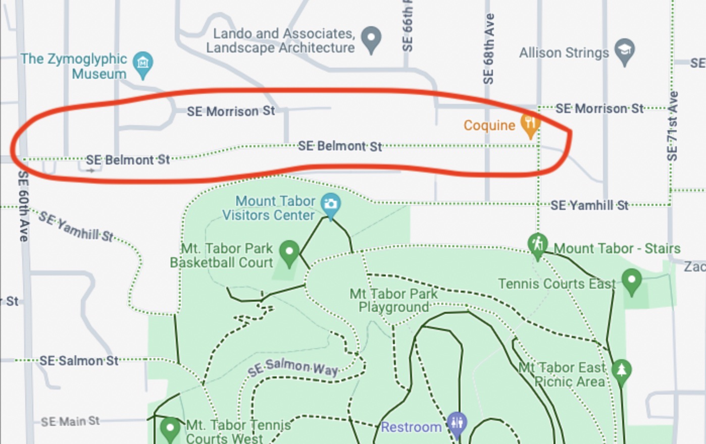
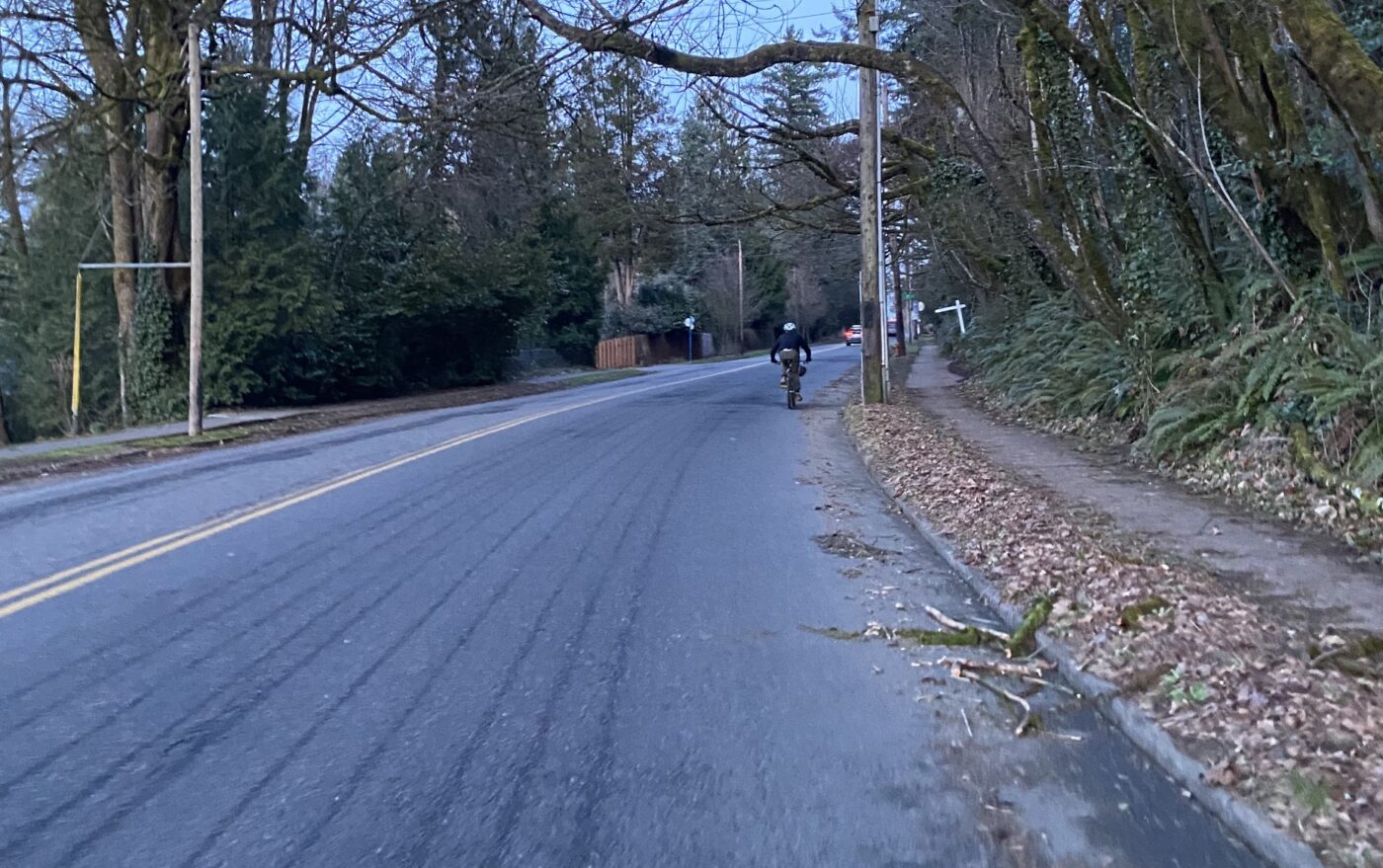
Google Maps likes to think areas are a lot more bikeable than they are. Take, for example, SE Belmont Street in the Tabor area. Google Maps shows a dotted green line – indicating a “bicycle friendly road”, usually meaning a Neighborhood Greenway. If you’ve ridden Belmont in this area, you’ll know it’s not a neighborhood greenway, and is in fact a bit of a thoroughfare between Tabor and Montavilla. The wide shoulder is filled with debris and Trimet buses whiz by. “BIcycle friendly”, not so much. For this reason, I’d cross-check with Pointz or the Bike Map whenever possible.
When showing how long a trip will take on transit, Google Maps has a strange habit of showing total time actively riding on transit instead of total trip time. That means if the bus arrives in 5 minutes and the ride is 20 minutes, Google Maps shows the trip (and your arrival time!) as 20 minutes, not 25 minutes. Honestly, this boggles my mind, because Google shows the realtime arrival – if they have the data in their system, why not incorporate it?

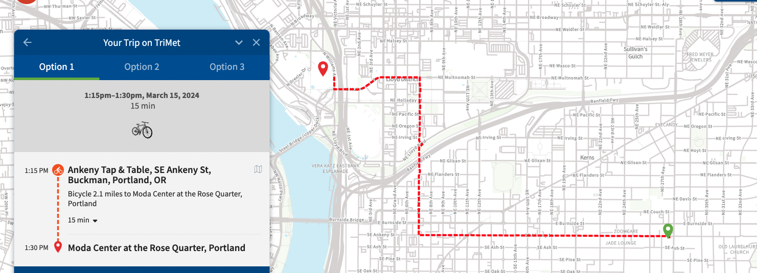
 TriMet trip planner screenshot
Find it at:
TriMet.org
Cost: free
Format: mobile and desktop website
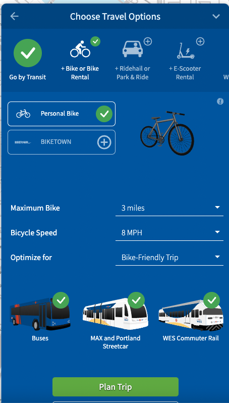
How it works: Enter your starting and ending location, and select what types of transit you would like to use. You can select additional modes such as bicycle or scooter rental, which the planning tool will factor into the overall trip time. Trimet will show you trip options, including price and trip time.
Ideal for: Planning ahead and comparing multi-modal options. The routing is similar to Google Maps, but the ability to select what transportation type you use in addition to Trimet gives much more flexibility than Google Maps. They even offer a bicycle-only routing option.
Low-data friendly?: No, requires internet connection.
Not ideal for: There is no option for turn-by-turn directions that follow your trip in real-time, or automatic re-routing. If you use this tool for on-the-fly navigation, you’ll have to commit the route to memory.

Last but not least, word of mouth and community input is a great way to learn how to get around. I’m surprised and grateful for how readily folks offer recommendations. I also enjoy riding on
Shift rides which help me see new parts of the city.
Bike Portland readers, which tools do you use regularly to plan your rides around town?
 (Jonathan Maus – BikePortland)
 (Erin Bailie – BikePortland)
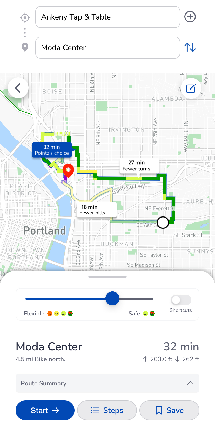 Pointz screenshot
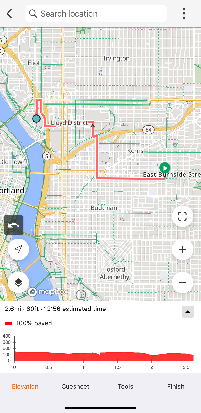 Ride With GPS screenshot
 Google Maps screenshot